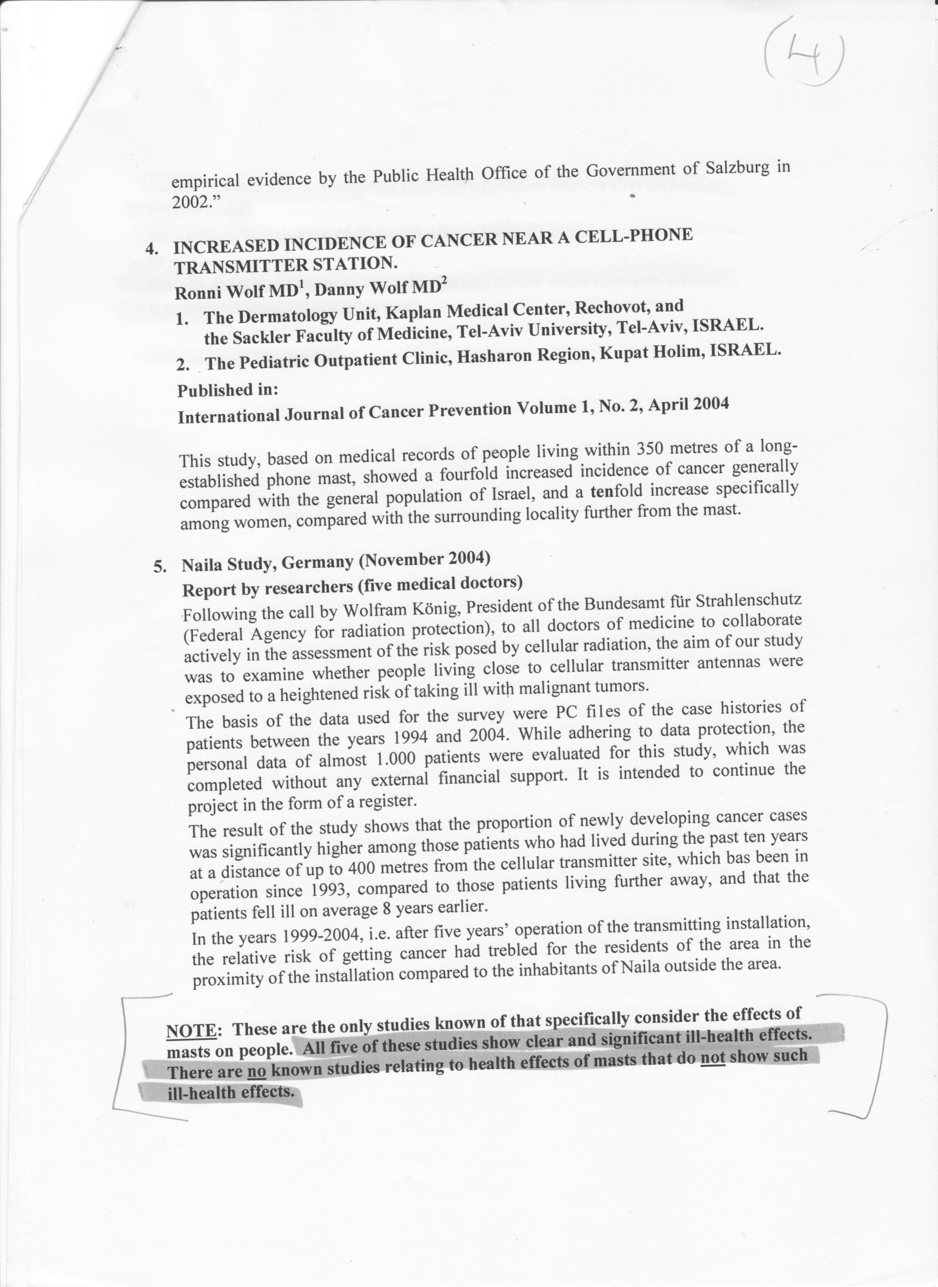
The People’s Health Survey Results.

Dear Members, at last I am able to publish the results of our survey. I have attached various documents below that you will need to reference as you read the report. There are three maps , one for each of the survey areas and one for the control area on which the data has been plotted. You will also find a ‘totals in numbers’ table and a ‘percentage totals’ table for each area. I would advise downloading the ‘Finalsurveyreport-1’ and looking at the other documents as they are referred to. When a file or document is referenced it will be in blue in square brackets and will appear below. It would be useful to download each of the maps [GGMap/BHMap/CDMap] and the [summary of issues] document so that you can see at a glance what each of the numbers on the map refer to. In reading the report you will see that masts other than the original target masts are mentioned. I speculate as to whether some of the incidences of conditions that we see in the Portslade site are perhaps related to the fact that the area is surrounded by a matrix of masts. We did some more recent readings on these other masts and our target masts just to see the strength of the signals being transmitted and these readings are also attached. As you look at these readings be aware that we are simply taking a snapshot of the situation and usually what we see is a lower end background signal interspersed with peaks and pulses which we remain long enough at each mast to detect. Ideally some sort of 24hr period of monitoring is required to give us a better idea of the true levels of RFr we are being exposed to. As we know, these masts are able to communicate with each other and we, the general public have no idea what frequencies, what output and for what duration they are being transmitted. There is no regulation and nor are there any limits to what the operators of these masts can do once they are in place. In some sense, it could be argued that the operators of the masts, facilitated by the local council and central Government are committing a trespass against the local population in these areas, an area we will look into further as an Association now that this survey is complete. What we can say for certain is that these masts transmit a signal into the ether which is being done without the consent of the local population , the question as to whether these signals are causing harm is in some sense a secondary question and perhaps we should be putting the onus on the telecom companies to show us the evidence that the masts cause no harm. In many ways the survey has thrown up a number of issues and questions that merit more investigation. I am proposing to approach and discuss the results with some of the Gossops’ Green residents over the coming weeks to see how this report and its findings might best be used. It may be of interest to note that in the Gossops Green area there is a primary school within 150m of the mast and a secondary school within 300m of it. I wrote to both schools, inviting staff to complete the questionnaire and and did not get a reply from either. A copy of the letter can be seen below. This survey and its supporting data/maps etc can be downloaded and used by anyone who feels they may be able to use it in some way to create change in out local communities.
Roy Williams, Sussex Residents Association, Chair 29/9/23